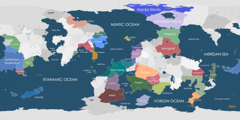
File:Map of Kerbin with countries.png
Jump to navigation
Jump to search

Size of this preview: 800 × 400 pixels. Other resolutions: 320 × 160 pixels | 1,638 × 819 pixels.
Original file (1,638 × 819 pixels, file size: 376 KB, MIME type: image/png)
Map of Kerbin with countries
File history
Click on a date/time to view the file as it appeared at that time.
| Date/Time | Thumbnail | Dimensions | User | Comment | |
|---|---|---|---|---|---|
| current | 08:36, 28 November 2023 | | 1,638 × 819 (376 KB) | Toonu (talk | contribs) | |
| 09:10, 5 May 2023 | 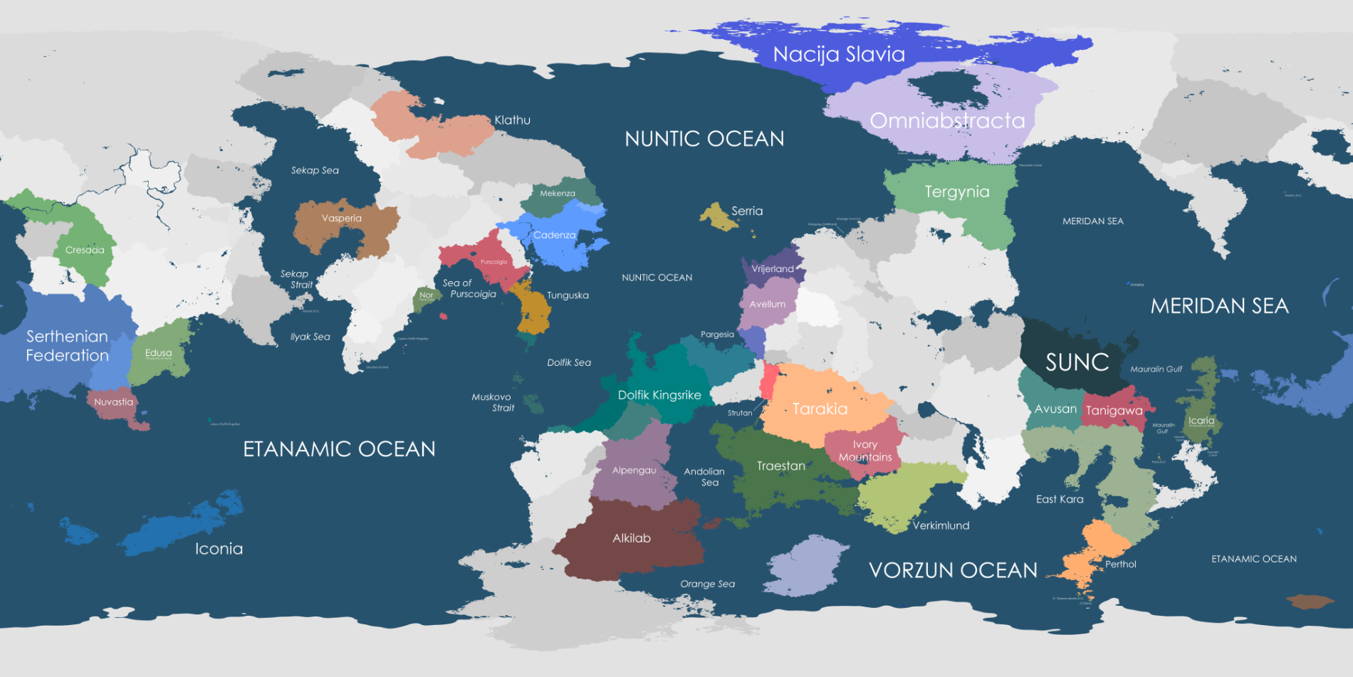 | 1,900 × 951 (511 KB) | AlpengauTemp (talk | contribs) | New map | |
| 19:07, 3 December 2022 | 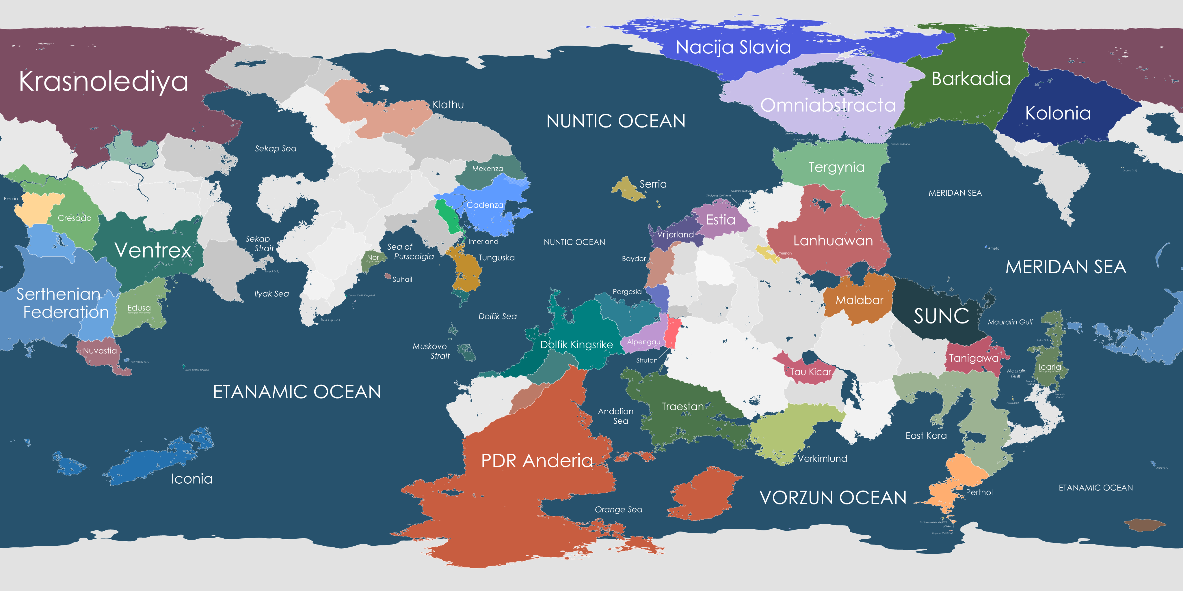 | 4,096 × 2,048 (1.21 MB) | Serria (talk | contribs) | ||
| 02:51, 15 June 2022 | 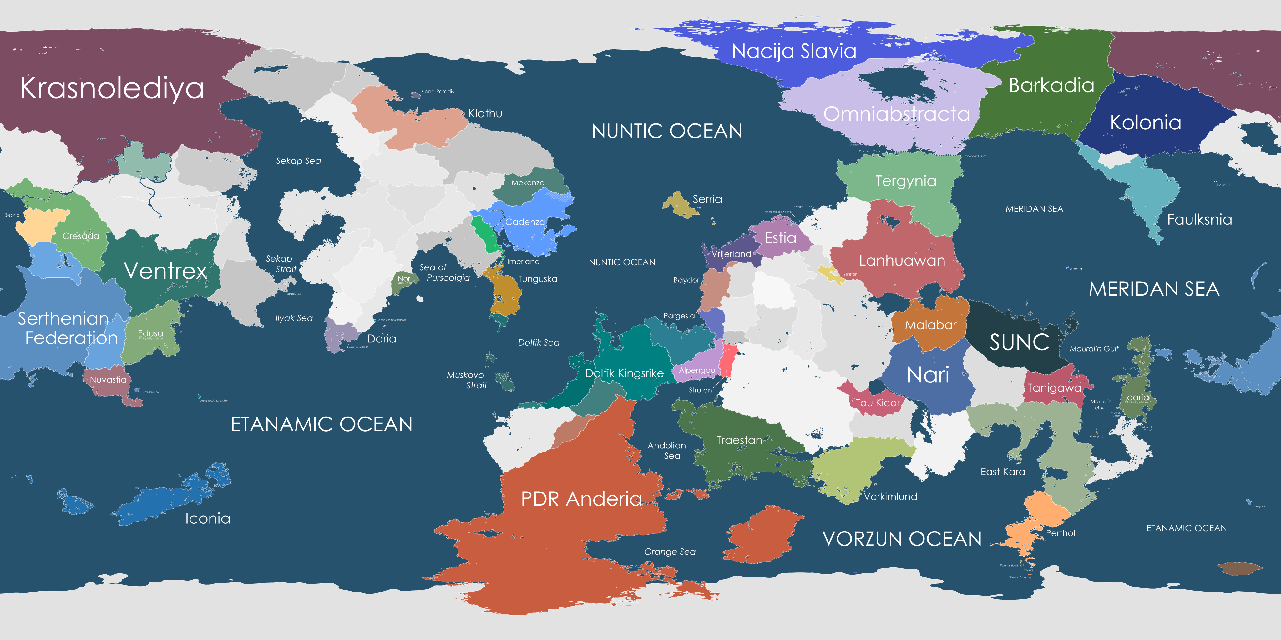 | 4,096 × 2,048 (1.22 MB) | Serria (talk | contribs) | ||
| 07:47, 8 June 2022 |  | 4,096 × 2,048 (1.21 MB) | Serria (talk | contribs) | ||
| 03:39, 2 June 2022 | 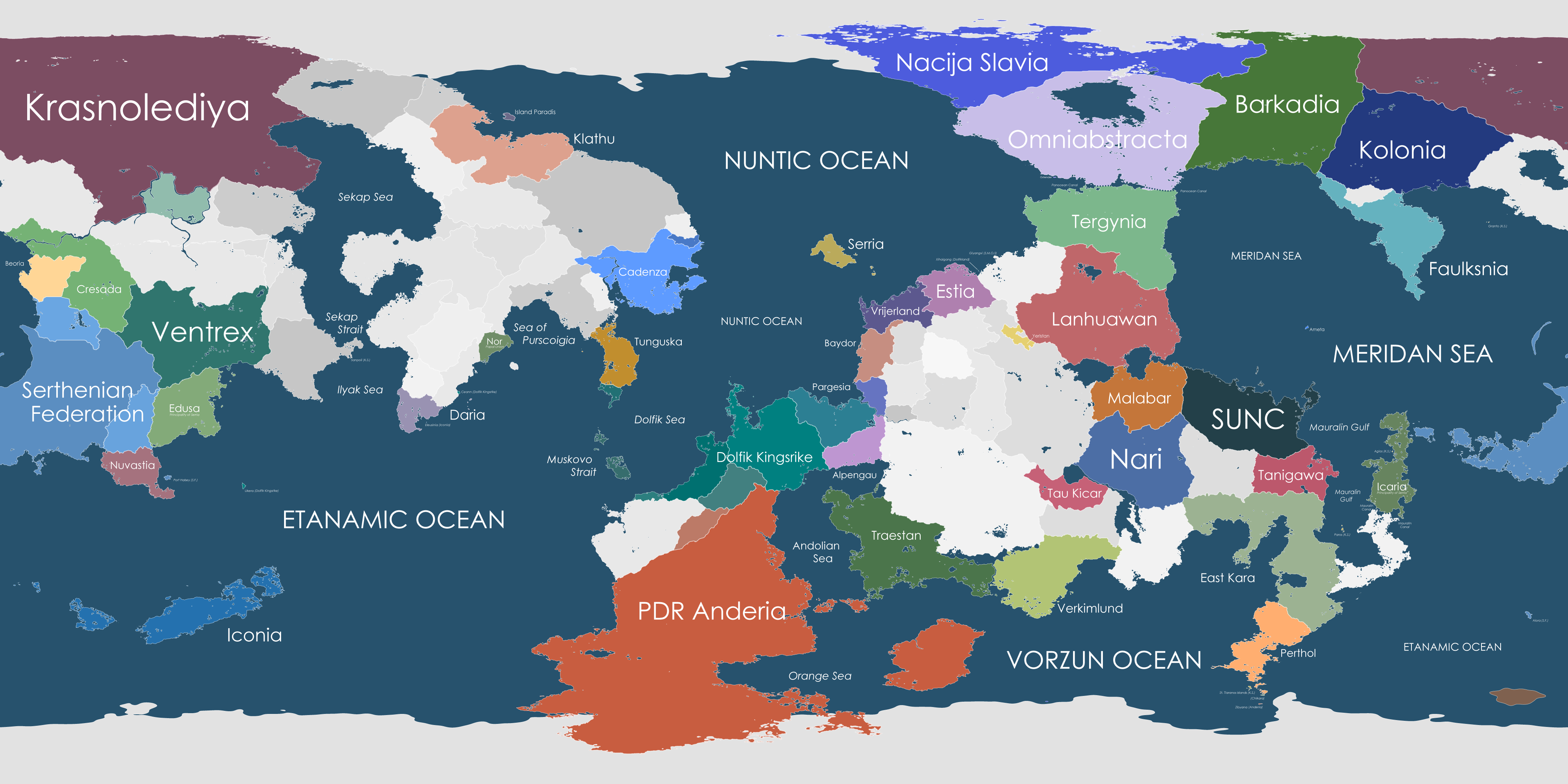 | 4,096 × 2,048 (1.21 MB) | Serria (talk | contribs) | ||
| 20:06, 24 March 2021 | 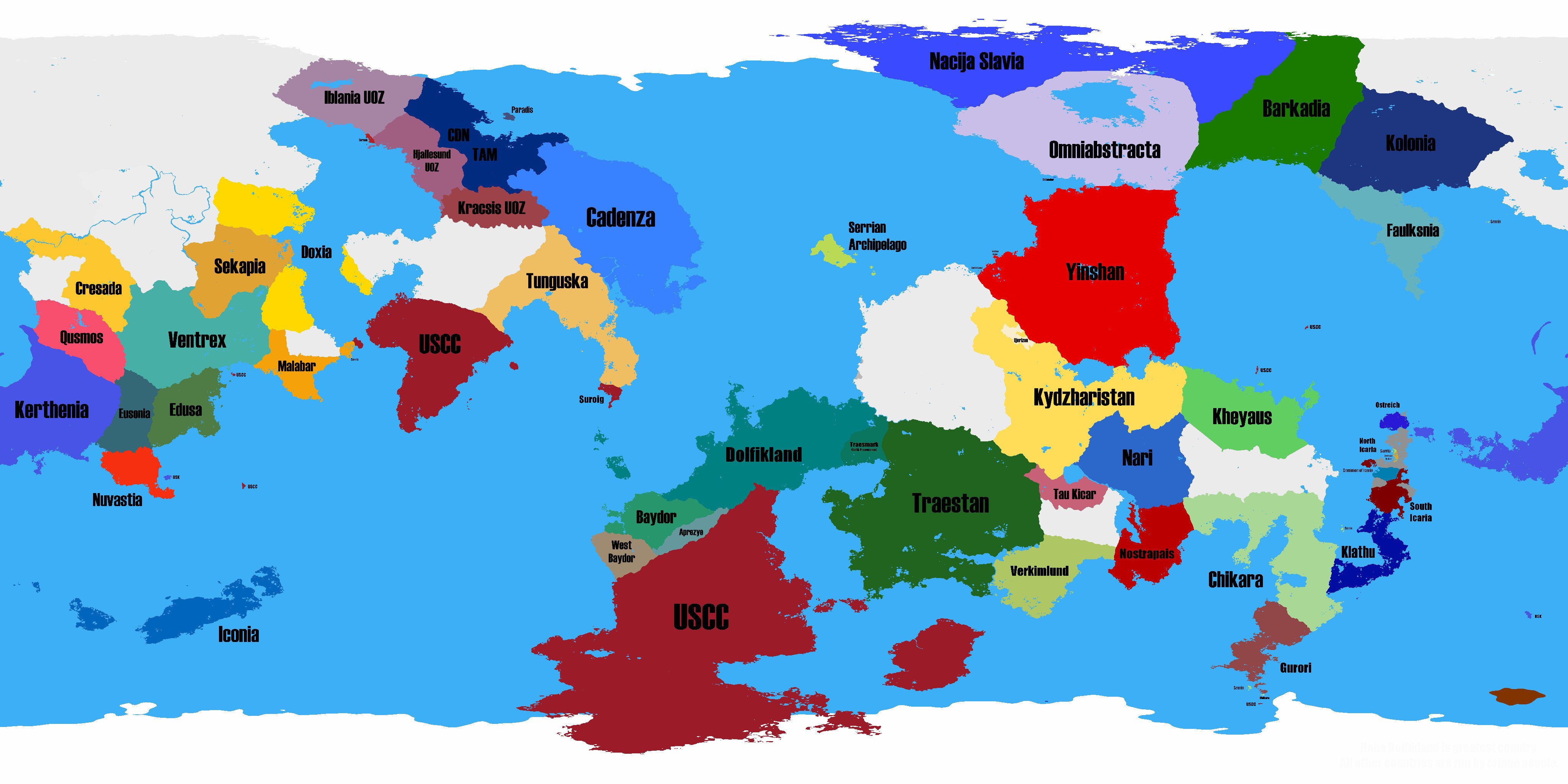 | 4,096 × 2,048 (2.24 MB) | Toonu (talk | contribs) |
You cannot overwrite this file.
File usage
The following 5 pages use this file: