File:Qjer Atlas Map.png
Jump to navigation
Jump to search

Size of this preview: 778 × 599 pixels. Other resolutions: 312 × 240 pixels | 1,617 × 1,246 pixels.
Original file (1,617 × 1,246 pixels, file size: 423 KB, MIME type: image/png)
Summary
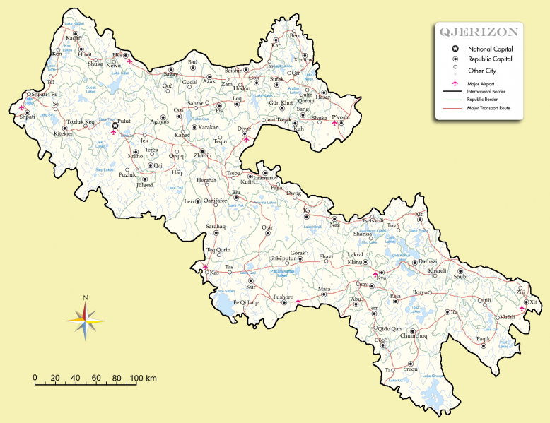
Atlas Map of Qjerizon/Yeristan
File history
Click on a date/time to view the file as it appeared at that time.
| Date/Time | Thumbnail | Dimensions | User | Comment | |
|---|---|---|---|---|---|
| current | 21:35, 31 March 2021 | | 1,617 × 1,246 (423 KB) | Nosirrbro (talk | contribs) | Atlas Map of Qjerizon/Yeristan |
You cannot overwrite this file.
File usage
The following page uses this file: